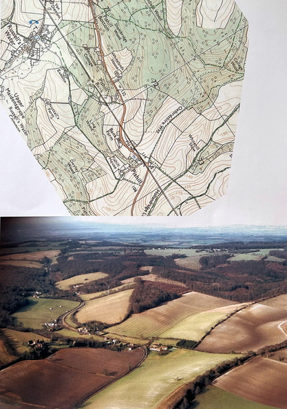
In those days, Colin, a maths lecturer at Brunel University, was doing flying expeditions over the Chilterns in a colleague’s 4-seater aeroplane from Booker Airport. He took aerial photos of our walks, to match printouts from the recently digitalised Ordnance Survey Maps which were now available online. I love the way you can see the landscape, e.g. the triangular wood, nicely correlating with the map. We did several walks around Pishill, ending with excellent lunches at The Crown and even took our daughter’s parents-in-law there. Sadly it has now closed.
Author: S Tripp
Author: S Tripp